Kiryat Arba
Masterplan for the Sha’ar HaAvot Station District
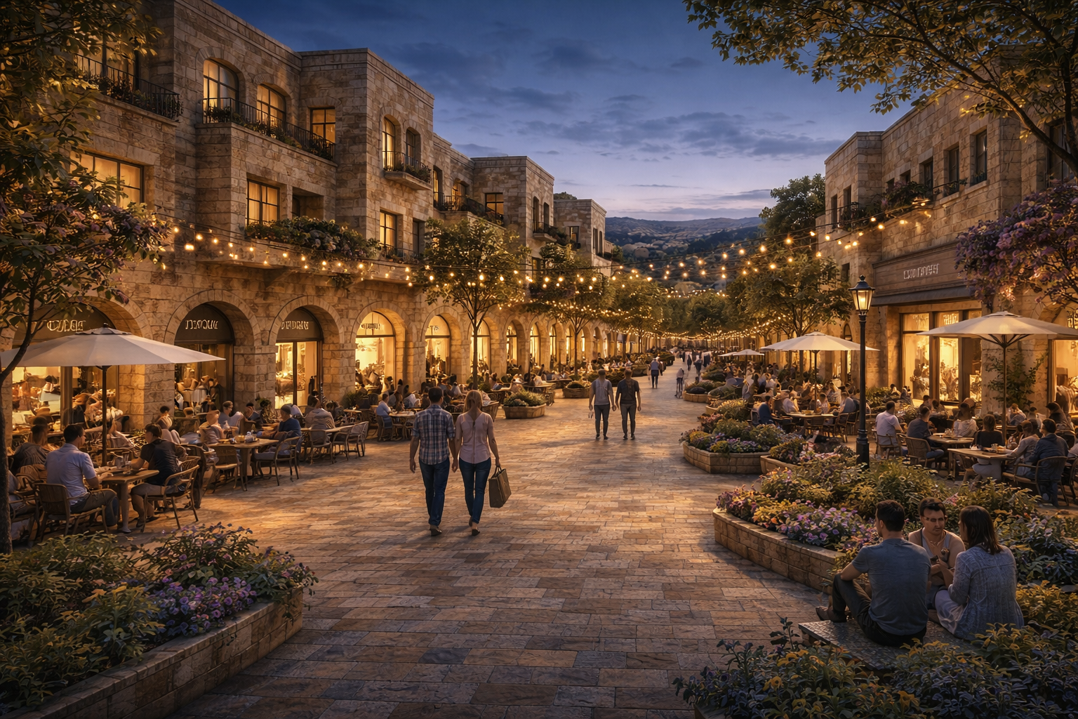
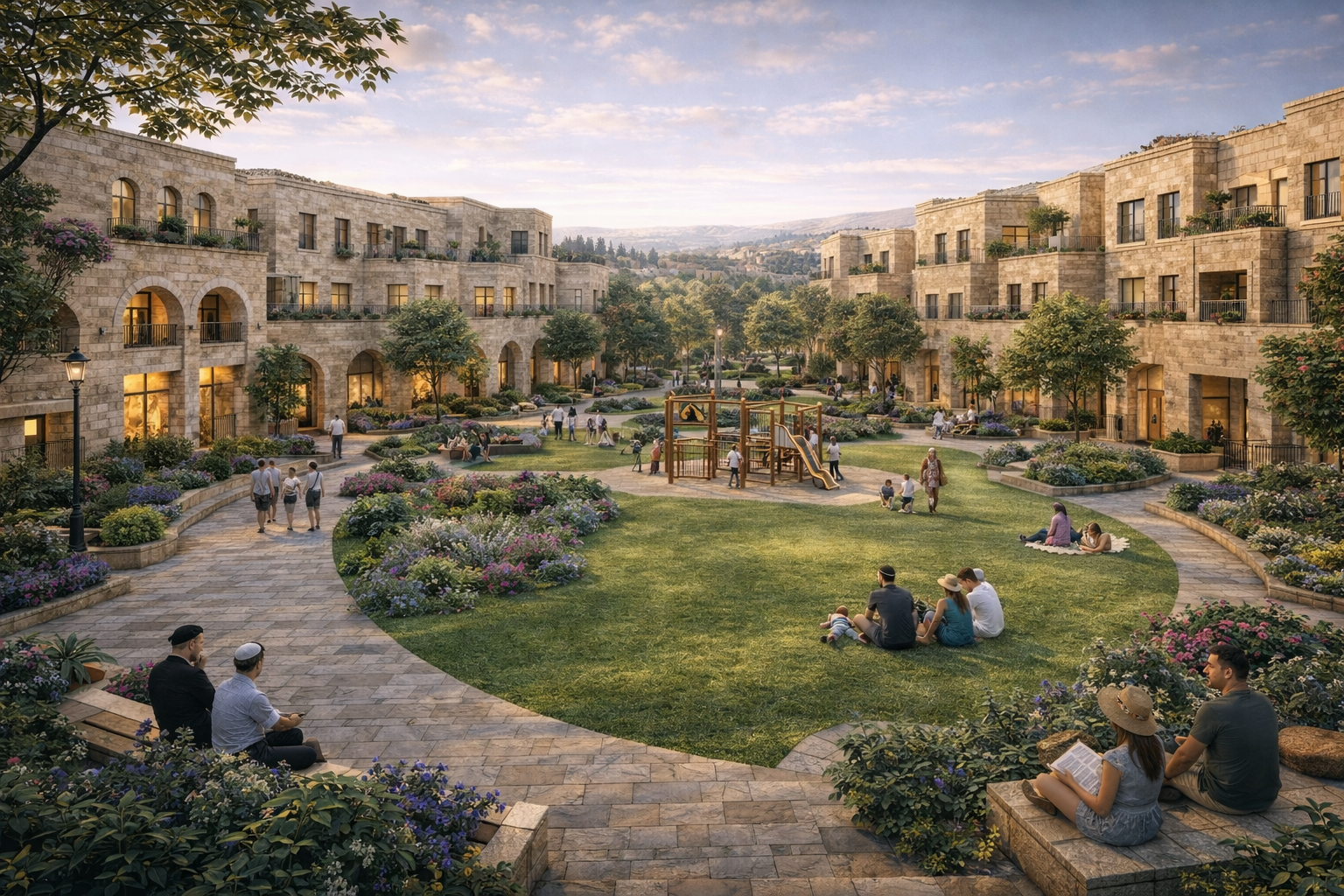
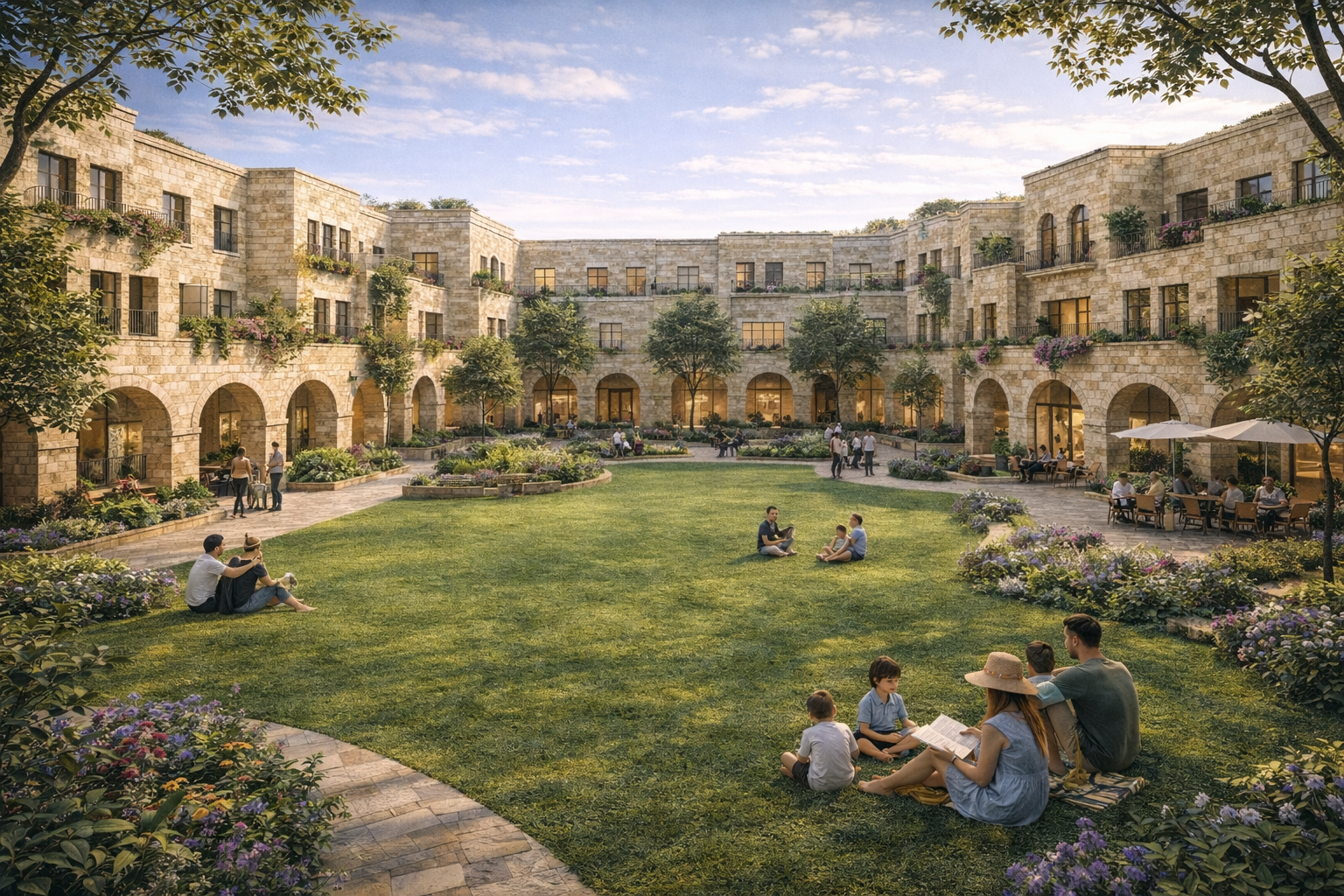
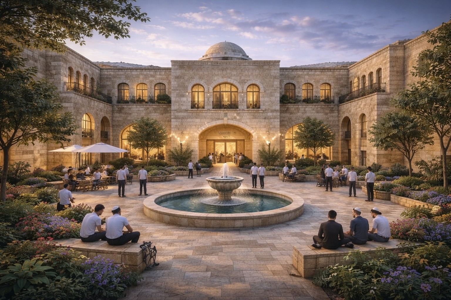
General Vision
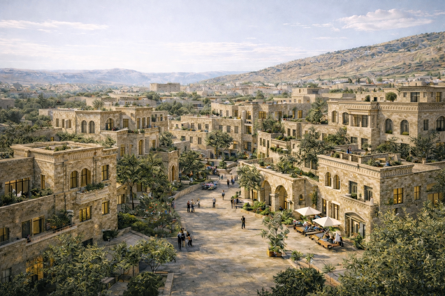
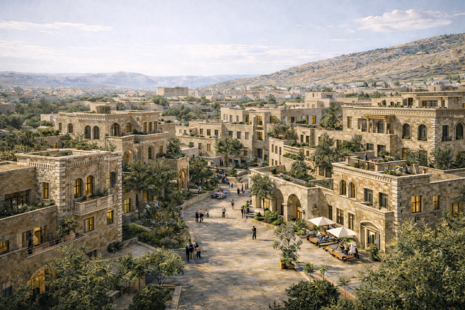
The masterplan proposes a phased urban development framework centered around the future Sha’ar HaAvot railway station, envisioned as a new civic, transportation, and economic anchor for Kiryat Arba and the greater Hebron region. The goal is to create a walkable, community-oriented, green, and sustainable city that can serve the existing population while allowing for long-term growth over a 20-year horizon. The plan is designed to accommodate a population increase from approximately 9,000 residents today to a future capacity of 18,000–27,000 residents, while preserving the identity, landscape, and historical character of the area.
Core Planning Principles
The development strategy is based on phased growth that strengthens the existing city rather than replacing it. Urban form is structured around the railway station as the central gateway and civic heart, ensuring that transportation infrastructure shapes healthy urban life rather than automobile dependency. The city is planned at a human scale, emphasizing walkability, mixed-use development, and a strong network of public spaces integrated into the surrounding landscape.
Phased Development Strategy
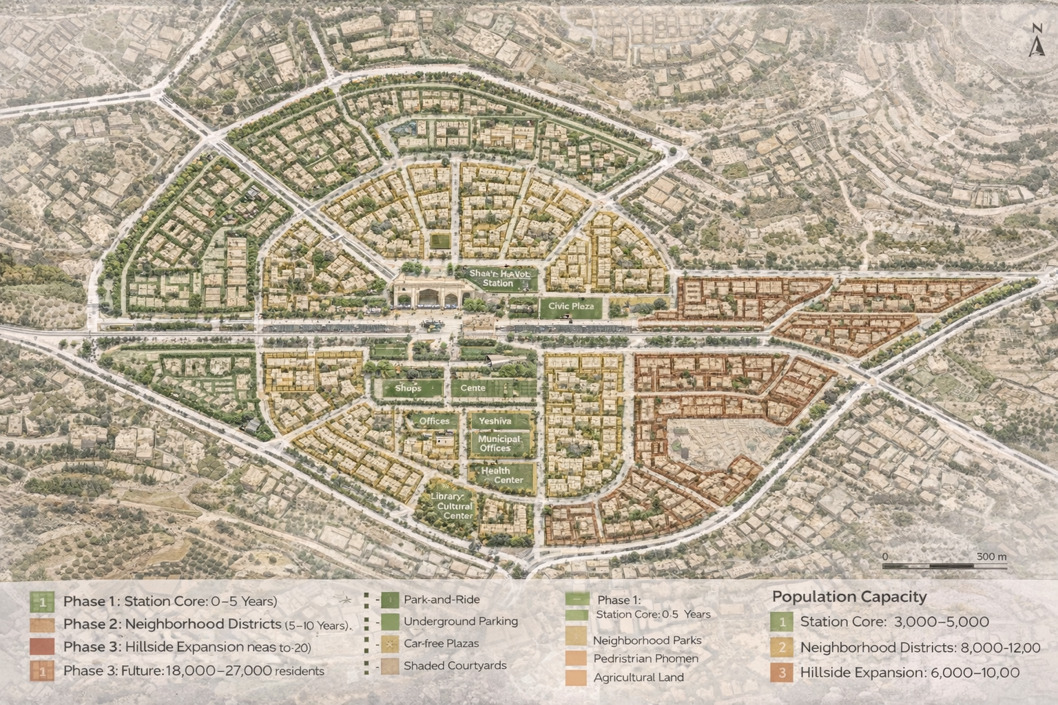
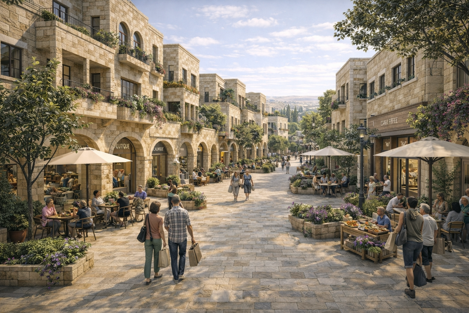
Phase One (Years 1–5) focuses on establishing the station core and civic center – including the railway station, a central public plaza, initial mixed-use blocks, and essential public institutions such as educational facilities, health services, and cultural buildings. This phase introduces the first new residential neighborhoods and provides the foundation for economic activity and community life, supporting an initial population increase of approximately 3,000–5,000 residents.
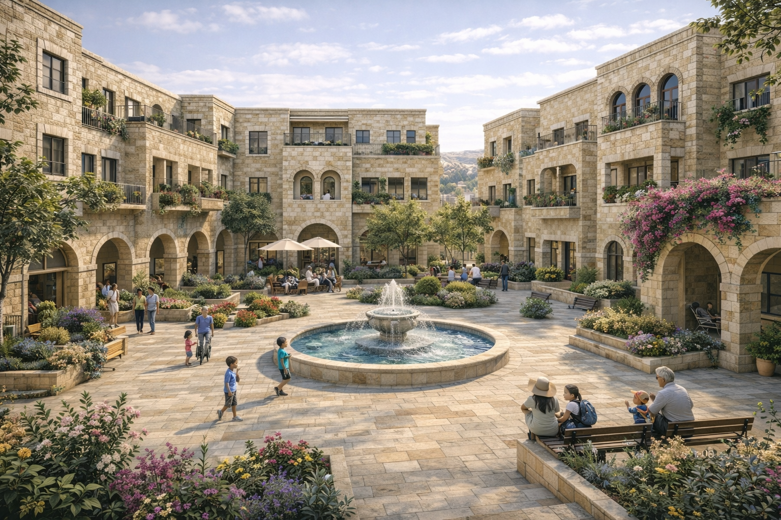
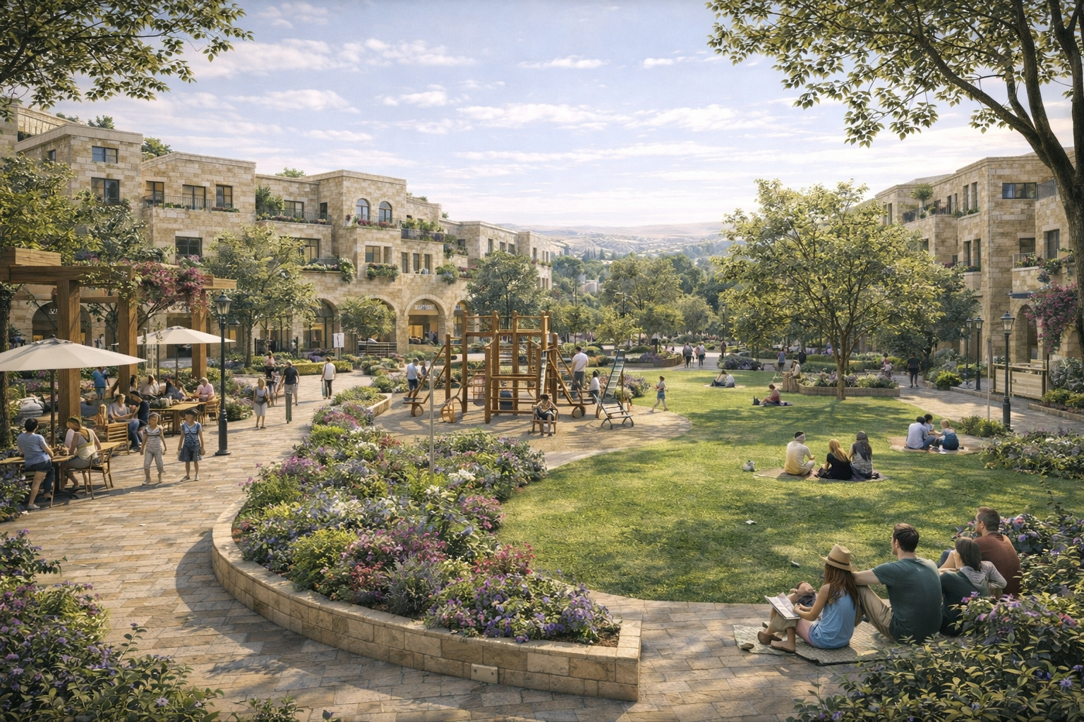
Phase Two (Years 5–10) expands the surrounding residential districts – developing full neighborhood clusters organized around green interior courtyards, schools, synagogues, parks, and local commercial streets. These districts are fully walkable, with daily services located within a five- to ten-minute walking radius. This stage supports an additional population growth of approximately 6,000–8,000 residents.
Phase Three (Years 10–20) completes long-term growth areas along the surrounding hillsides – introducing terraced housing, tourism and hospitality clusters, ecological neighborhoods, and landscape buffers that define the city’s boundaries and prevent uncontrolled sprawl. This phase allows the city to reach its ultimate capacity of 18,000–27,000 residents while maintaining its connection to nature and topography.
Urban Structure
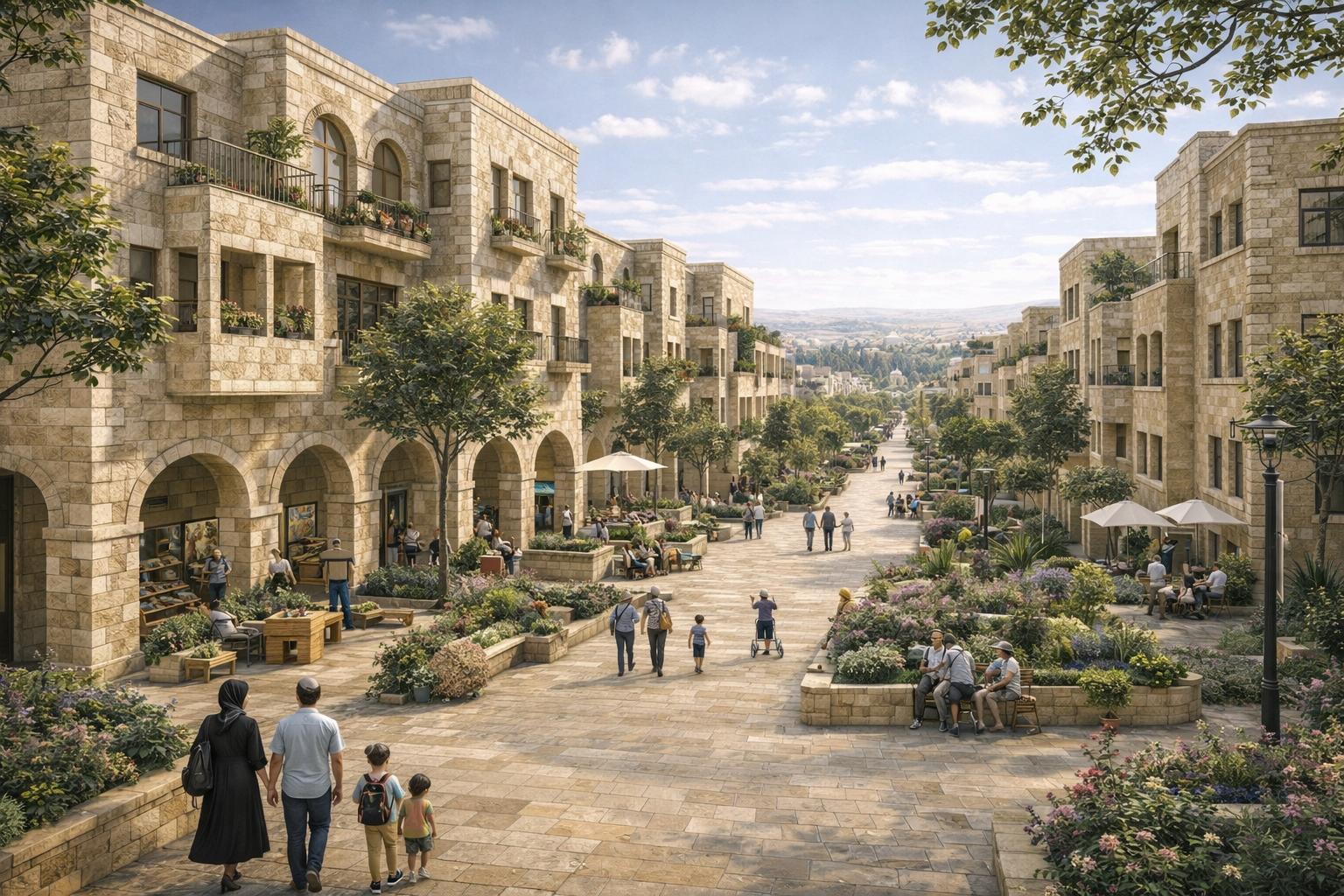
The city is organized around a central civic axis extending from the railway station into a public square that functions as the heart of Kiryat Arba. Surrounding this core are residential neighborhoods arranged in concentric development rings. The inner zone contains the highest density and most active urban functions, while outer areas gradually transition into lower-density hillside districts. Pedestrian boulevards and shaded streets link all neighborhoods directly to the station and central plaza, ensuring continuity between transportation and daily life.
Housing and Building Typologies
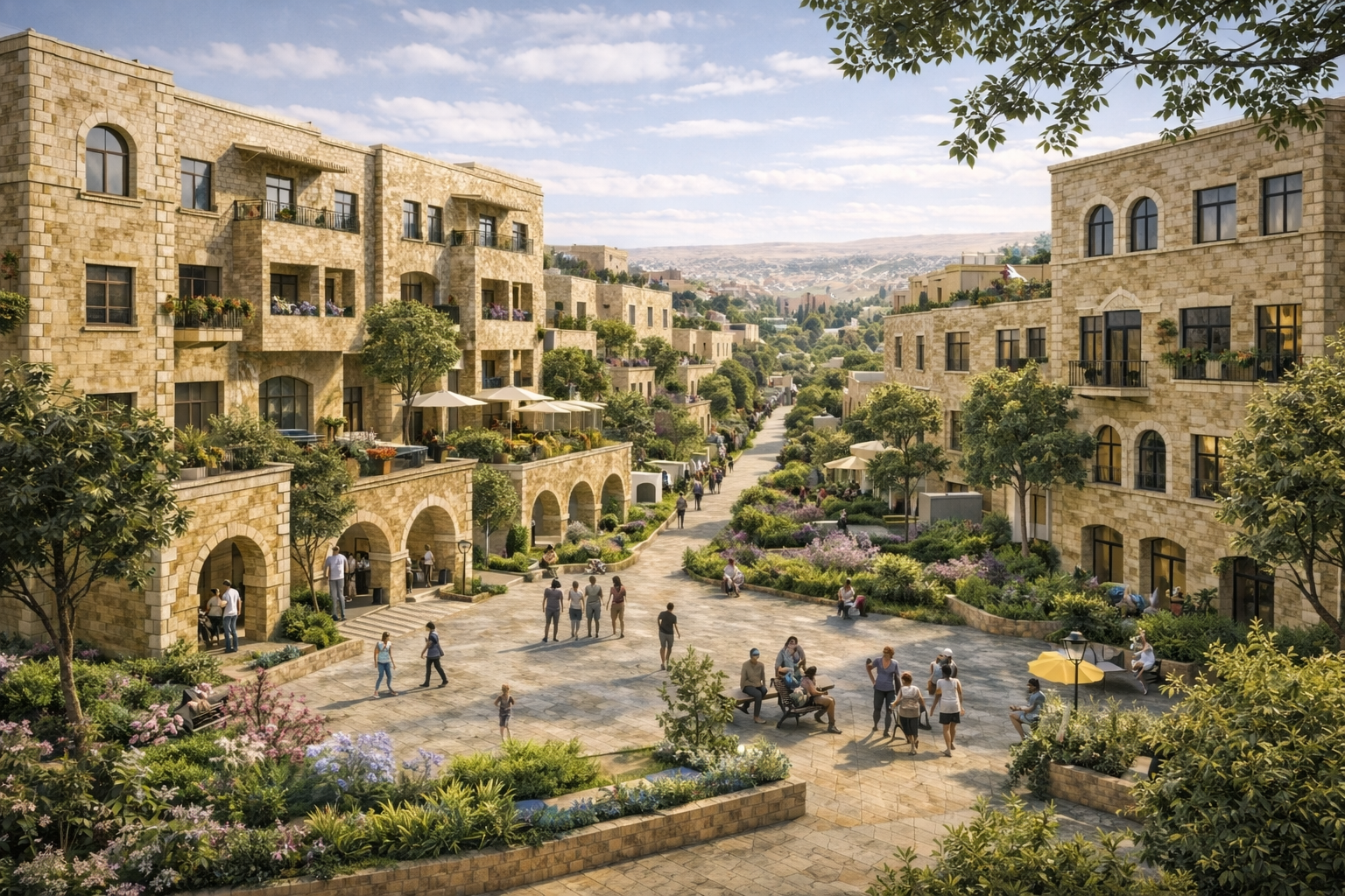
Residential development is based primarily on courtyard blocks inspired by the historic urban fabric of Jerusalem, Hebron, and Tzfat. Buildings rise between three and five stories and are arranged around shared interior gardens. Balconies are designed to accommodate sukkahs, and façades use local stone and climate-responsive materials. Mixed-use buildings near the station combine ground-floor commercial spaces with residential units above, while hillside districts introduce terraced housing with roof gardens and views toward the surrounding landscape. This diversity allows the city to serve families, students, young professionals, and elderly residents.
Architectural Language and Materials
Architecture draws from regional traditions while employing modern construction methods. Locally sourced limestone, stone arches, colonnades, and deep balconies define the visual identity of the city. Shaded walkways, passive cooling strategies, and natural ventilation ensure comfort throughout the year. Rooflines are designed to integrate solar energy systems and green terraces, reinforcing sustainability while maintaining a cohesive and dignified urban character.
Public Space and Landscape Network
A continuous system of public spaces connects the railway station plaza with surrounding neighborhoods. This network includes a central civic square, pedestrian boulevards, interior courtyard gardens, neighborhood parks spaced every few hundred meters, market streets, and community gathering areas. Trees, water features, and shaded seating respond to the local climate and provide comfortable outdoor environments for daily life and social interaction.
Mobility and Transportation
The district is planned according to transit-oriented development principles, prioritizing pedestrians and public transportation over private vehicles. Direct walking routes link residential areas to the station, supported by bicycle paths and shaded promenades. Local shuttle and bus connections serve the wider region, while parking is concentrated at the edges of the district or underground. The railway station functions as an integrated urban gateway rather than a traffic barrier.
Economic and Civic Framework
The station district concentrates civic and employment functions near the rail hub. These include municipal services, educational institutions, medical facilities, cultural venues, libraries, coworking spaces, and small business centers. This framework transforms Kiryat Arba into a regional service and employment center, strengthening its economic base and reducing dependence on distant urban cores.
Sustainability and Environmental Strategy
The masterplan integrates climate-responsive design principles through passive building orientation, natural lighting, cross-ventilation, rainwater collection, and the use of native, low-water vegetation. Solar energy systems on rooftops and shaded arcades reduce energy demand and improve environmental performance, creating a resilient and future-oriented urban model.
Conclusion
The Sha’ar HaAvot Station District masterplan presents a new vision for urban growth in Kiryat Arba – a rail-centered, community-driven city that balances heritage and innovation. By uniting transportation, architecture, public space, and phased development into a single framework, the plan establishes a long-term model for high-quality peripheral growth in Israel. It demonstrates how infrastructure can shape not only movement, but identity, opportunity, and sustainable urban life.
All city designs are the exclusive property of Michiya and its affiliates. They may not be used for commercial use without the express approval of the organization.